Boundary Surveys in Hawaii
Purpose: To review boundary records and establish the current boundary to protect the existing rights acquired under the original surveys.
Occasionally, the record boundary of an individual lot either does not match improvements found on the ground or the property deed. CM&E can review records of previous subdivisions and field observations to make a lot determination which establishes a new record boundary that best conforms to historical information and existing improvements. This new record boundary can be used to update the zoning lot recognized by the country for permit purposes and even update the deed in some instances.
Featured Projects
Project: Land Survey, Standard Boundary Evidence Reports for Hawaiian Home Lands (Trust Lands)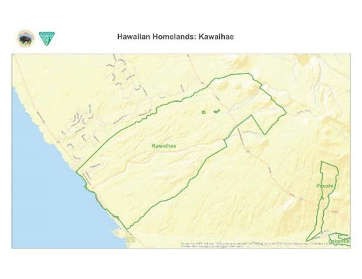
Location: Island of Hawaii, Hawaii
Component(s): Land Surveyor Reports, Boundary Survey
The Hawaiian Home Lands, or Trust Lands, are public lands set aside by the Hawaiian Home Lands Commission to be used for homesteads. Beneficiaries can receive 99-year homestead leases at $1/year for residence, agriculture, or pasture. They can also receive loans for home purchase, construction, and repair.
CM&E compiled Land Surveyor Reports for the United States Department of the Interior, Bureau of Land Management (BLM). These Land Surveyor Reports were part of a Standards of Boundary Evidence (SBE) to confirm boundaries of existing Hawaiian Home Lands that were transferred from the U.S. Federal Government to the Hawaii Home Lands Commission.
The SBE is a standardized risk-based system to identify and document boundary evidence for lands administrated by most bureaus and offices of the Department of Interior. These assist bureau and office managers in deciding whether a boundary is sufficient for the planned land usage. In this case, the SBE was intended to help the BLM decide whether the property boundaries were sufficient for the Hawaiian Home Lands land transaction. For this project, CM&E:
- Reviewed land descriptions
- Researched the chain of surveys
- Investigated possible unrecorded interests
The SBE’s land parcels cover a total area of over 1,000-Ac, spread across five general land tracts on Hawaii Island. In most cases, the establishment of the chain of surveys extends back to the late 1800s.
 Project: 3238 Mokihana St. Residential Subdivision
Location: Honolulu, Oahu, Hawaii
Component(s): Zoning Lot Subdivision, Lot Determination, Variances
CM&E was retained to perform a topographic survey and subdivision of an existing 10,000-sf residential lot with two existing single-family homes. CM&E found a discrepancy between the property records and the field conditions after completing the topographic survey. CM&E studied the available records for the original subdivision and subsequent surveys, prepared a lot determination request for DPP Subdivision Branch review, and re-surveyed the parcel to adjust the record boundaries based on our findings. The lot was subdivided and the property corners staked using the new record boundary.
As part of the subdivision processing, CM&E also processed a sewer connection for the new lot, filed a surface encroachment variance for an existing walkway and a driveway variance for the existing driveway.
Explore the different CM&E Land Surveying Services below
- Topographic Surveys
- ALTA / Boundary Stakeout and Perimeter Surveys
- Shoreline / Elevation Surveys
- Subdivision / Land Court / CPR Mapping
- Construction Staking
- Boundary Surveys
CM&E also offers Master Planning & Design Services.